
Evia (South)
3.9/5Karystos, the Dragon Houses, Mt Ochi and the Dimosari Gorge — south Evia is the wild end
Karystos as your base. The Castello Rosso, the Dragon Houses on Mt Ochi, the full Dimosari Gorge walk, and three of Evia's best beaches.
South Evia is the island's most dramatic third — Mt Ochi (1,398m) rising sharply from the sea, the prehistoric "Dragon Houses" stone monuments at the summit, the Dimosari Gorge cutting north to south, and Karystos as the base — a low-key Aegean town with a Venetian castle. The water is warmer here than the rest of Evia, the beaches are sandier, and the road network is gloriously underdeveloped. Reach south Evia from Athens via the Marmari ferry (1h crossing from Rafina) — much faster than driving via the Chalkida bridge and down the length of the island.
Getting there
South Evia is reached from Rafina (30 min east of Athens) via the Marmari ferry — frequent daily crossings, ~1 hour, takes cars.
Read full route
Karystos is a 15-minute drive from Marmari port. The Chalkida route is much slower (3+ hours of internal driving).
Tip: Book the ferry in advance for summer weekends — Athenians flood Karystos and the boat sells out.
Best time to visit Evia (South)
Southern Evia means Karystos and Mt Ochi — the Dragon Houses (drakospita), Castello Rosso, the Dimosari gorge. Drier and rockier than the north, with strong winds in winter. Best May-October. Karystos itself is sleepy off-season but never closes; the mountain hiking is great year-round if you bring proper kit.
3-day itinerary for Evia (South)
Day 1: Athens → Karystos & Castello Rosso
- 10:00 · Drive Athens → Rafina → Ferry to Marmari
30min drive to Rafina, then 1h ferry to Marmari (frequent crossings, takes cars). Marmari to Karystos is another 15 min drive.
- 🍴 Stop for lunch · Karystos (seafront) — see Eat & Drink below
- 16:00 · Castello Rosso (Bourtzi)
13th-century Venetian-built castle on the hill above Karystos. 30-minute climb up — sunset views over the bay are the reward. The lower 'Bourtzi' tower in town is also worth the 15 minutes.
- 18:00 · Agia Paraskevi Beach
The Karystos town beach — fine sand, calm shallow water, walking distance from the dinner spot. After the climb up to Castello Rosso, an unhurried late-afternoon swim feels well earned. Locals and visitors mix here without the busy energy of southern Aegean beaches.
- 🍴 Stop for dinner · Karystos — see Eat & Drink below
Day 2: Mt Ochi & the Dragon Houses
- 08:30 · Drive to the Mt Ochi trailhead (Mili village)
30min drive northeast to Mili — the village at the foot of Mt Ochi where the trail begins. Park, fill water bottles at the village spring.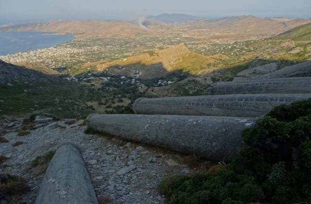
- 10:00 · Hike Mt Ochi → Dragon Houses
3-hour hike to the summit (1,398m). The reward is the prehistoric Drakospita — massive stone structures of unknown origin from ~600 BC. Views across to Andros and the open Aegean.
- 🍴 Stop for lunch · Mili village — see Eat & Drink below
- 16:30 · Agios Dimitrios Beach
Come down off Mt Ochi and drive out to Agios Dimitrios — a long sweep of sand on the exposed east coast, under the ridgeline wind farms. Wide open and often brushed by the meltemi: glorious on a calm day, dramatic when it blows. Remote and barely organised, so carry water — the reward is space and quiet after the climb.
- 🍴 Stop for dinner · Karystos (marina) — see Eat & Drink below
Day 3: Dimosari Gorge & Departure
- 09:00 · Drive to Lenosaioi village (Dimosari trailhead)
40min drive northeast through the mountains to Lenosaioi — the village where the gorge walk starts. Or hire a 4x4 transfer; the locals know.
- 10:00 · Walk Dimosari Gorge
3-hour walk through one of Greece’s prettiest gorges — running water year-round, plane trees, small natural pools to swim in along the way. Ends at Kallianou beach. It’s a one-way route, so plan how you’ll get back: the trailhead and the beach are far apart by road, so arrange a lift, taxi or second car — you can’t simply walk back to where you parked.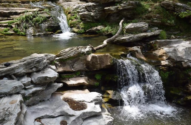
- 13:30 · Lunch & swim — Kallianou Beach
The gorge spits you out at one of the wildest beaches on the island — rocks, clear water, no development. Two seasonal canteens for cold beer and grilled fish.
- 17:00 · Drive back to Marmari → Ferry → Athens
1h drive back, 1h ferry to Rafina, 30min drive to Athens. Total ~3h door to door. Book the ferry in advance for summer weekends.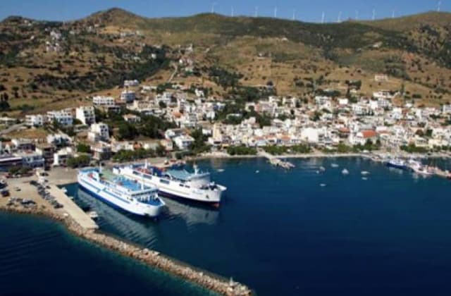
Top beaches of Evia (South)
Agia Paraskevi (Karystos)
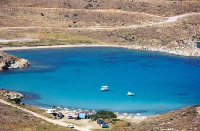
The 1.5km town beach of Karystos — fine sand, shallow water and the Venetian Bourtzi tower as a backdrop. Fully organised with sunbeds, cafés and tavernas along the front, and by far the easiest beach to reach in south Evia. The gentle counterpoint to the wild coves further out.
- Type
- sandy
- Length
- 1.5 km
- Depth
- Shallow — gradual sandy entry
- Wind protection
- South-facing — sheltered from the meltemi (the summer N/NE wind); calm in summer, exposed only to rare southern winds
- Facilities
- Fully organised: sunbeds, beach bars, cafés and tavernas along the front; easy parking, walkable from Karystos town.
Kallianou Beach
The wild mouth of the Dimosari Gorge — pebbles, deep clear water and no development at all. You reach it on foot down the gorge or by 4x4 on a rough track, and there's nothing here but the sea, so bring everything. One of the many south-Evia beaches that make you work for them.
- Type
- pebbly
- Length
- 300 m
- Depth
- Deep — drops off quickly, very clear
- Wind protection
- East-facing — mostly sheltered from the meltemi (the summer N/NE wind); can be choppy on the strongest NE days
- Facilities
- None — no shade, water or canteen. Reached on foot down the Dimosari Gorge or by 4x4 on a rough track.
Marmari Beach

The sandy beach right by Marmari's ferry port — handy for a swim before or after the Rafina crossing. Calm, shallow, kid-friendly water with a few cafés steps away. The convenient one, not the spectacular one.
- Type
- sandy
- Length
- 400 m
- Depth
- Shallow — calm, kid-friendly
- Wind protection
- Southwest-facing — sheltered from the meltemi (the summer N/NE wind); calm in summer, exposed only to rare S/SW winds
- Facilities
- Organised: sunbeds and cafés; steps from the ferry port and parking.
Livadi Beach

A long, open sand beach on the wild southeast coast below Platanistos, deep in the remote Kafireas (Cavo d'Oro) corner. Undeveloped and often deserted, reached only by a long drive on rough roads — bring your own shade, water and food. South Evia hides dozens of beaches like this: superb, but you earn them.
- Type
- sandy
- Length
- 600 m
- Depth
- Shallow to medium — clear open water
- Wind protection
- East-facing — mostly sheltered from the meltemi (the summer N/NE wind); can be choppy on the strongest NE days
- Facilities
- None — undeveloped. Long drive on rough roads below Platanistos; bring shade, water and food.
Potami Beach
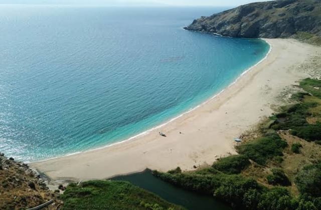
Sand-and-pebble beach at a river mouth (potami = river) in the far southeast near Platanistos, where the stream meets the sea in cold-fresh, crystal water. No facilities whatsoever, and the unpaved approach keeps it empty even in August. Remote in the best way.
- Type
- sand & pebble
- Length
- 250 m
- Depth
- Medium — cool and fresh where the stream meets the sea
- Wind protection
- Southeast-facing — sheltered from the meltemi (the summer N/NE wind); calm most days, exposed only to rare southern winds
- Facilities
- None — unpaved approach, no services at all.
Agios Dimitrios Beach
A long sandy beach on the exposed east coast beneath the Kafireas wind farms. Wide open and often wind-brushed by the meltemi — magnificent on a calm day, wild when it blows. Remote and lightly organised at best, and part of the string of hard-to-reach beaches that make this coast special.
- Type
- sandy
- Length
- 800 m
- Depth
- Shallow — gradual sandy entry
- Wind protection
- East-facing — mostly sheltered from the meltemi (the summer N/NE wind); can be choppy on the strongest NE days
- Facilities
- Minimal — a seasonal canteen at most; remote, below the ridgeline wind farms.
Giannitsi Beach

A broad sweep of fine sand by the hamlet of Giannitsi on the east coast — turquoise water, a wild backdrop and minimal facilities. Among the best beaches in south Evia, and like most of them, a commitment to reach: the last stretch is unpaved.
- Type
- sandy
- Length
- 500 m
- Depth
- Shallow to medium — turquoise water
- Wind protection
- East-facing — mostly sheltered from the meltemi (the summer N/NE wind); can be choppy on the strongest NE days
- Facilities
- Minimal — a seasonal canteen at most; the last stretch of road is unpaved.
How does Evia (South) compare?
Evia (South) vs Evia (Central) · Evia (South) vs Evia (North)